Updating Mississauga’s visitor guide map
The City of Mississauga publishes an annual visitor guide showcasing local attractions. They distribute over 120,000 copies of the print version with the map on a tear-away page at the back of the guide. The guide is available on visitmississauga.ca as a PDF download.
For the past 3 years I’ve updated maps for Mississauga’s visitor guide. They were referred to me by Mississauga’s Active Transportation department after working with them on their cycling map.
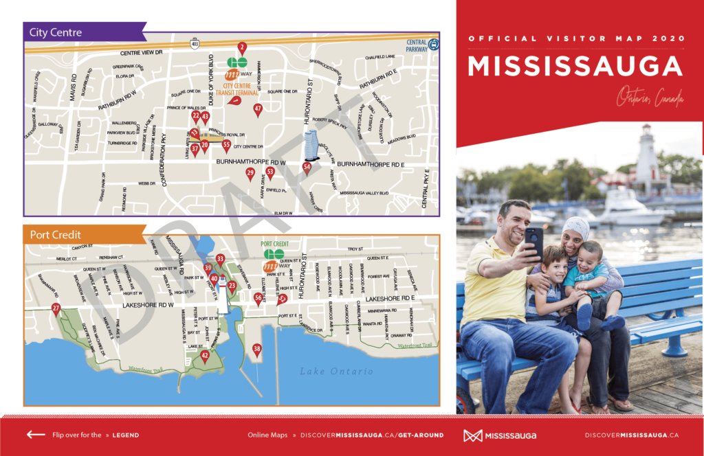
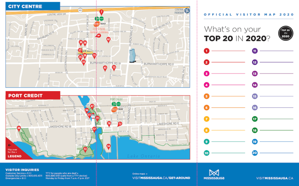
Tourism Mississauga first approached me in 2017 to recreate and update their existing maps for 2018. They wanted to change the style of the map, add the villages, and a legend grouping the attractions by category. The main map is on one side of the printed page and the City Centre and Port Credit maps are on the reverse.
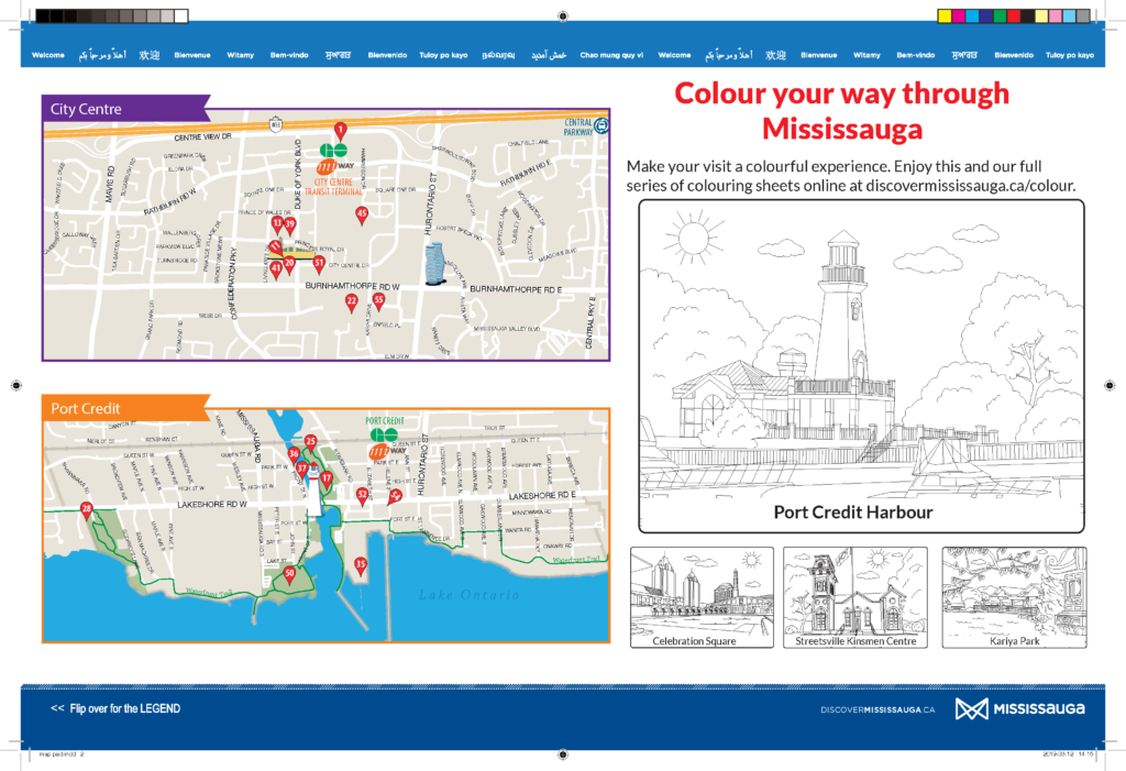
They also wanted a print-ready template for a double-sided map pad, which is provided to local hotels for them to tear off a copy to give to their guests. Last year the City sent me images for colouring to add to the template.
We worked together again for the 2019 update. Their designer provided updated colours and font changes for their guide, which I incorporated into the files for both print versions and the online PDF.
And we’ve just finished the 2020 update. In early November they sent a list of the types of changes to be made, along with a preliminary schedule.
We started work in early December with the detailed list of changes they wanted – mostly removing some points and adding new ones – and I sent the first draft with the same design as last year.
As always, it’s important to get the content right first, then work on style.
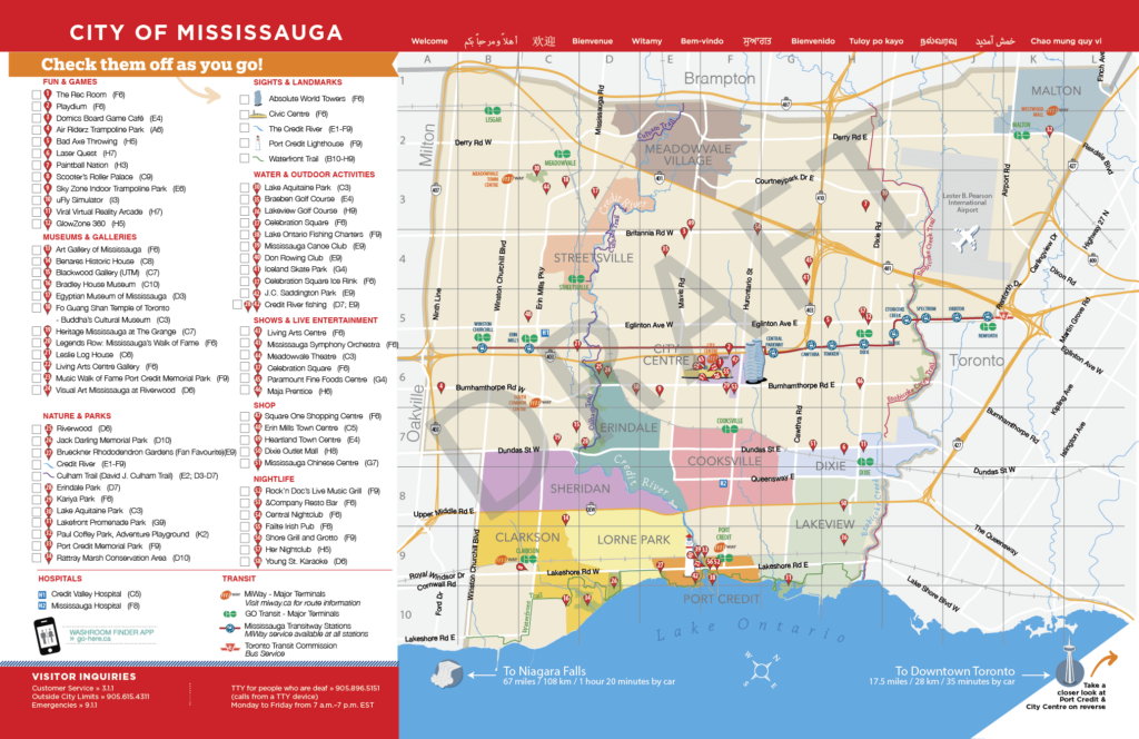
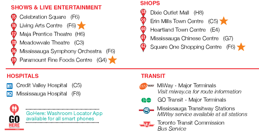
In early January they finalized listings for the guide and I prepared a second draft, which included reorganizing the legend and renumbering the points of interest, removing the bottom border to make room for more items in the legend, changing border colours, and correcting the Vietnamese and Urdu translations along the top border.
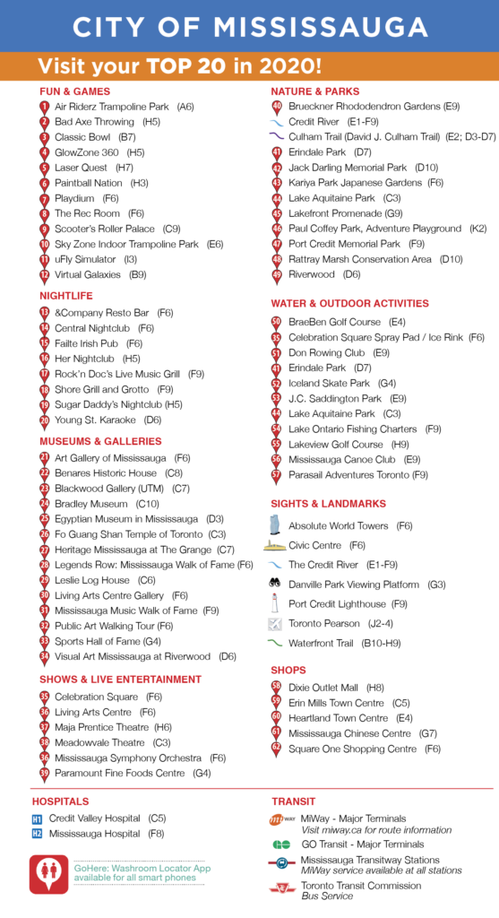
In February we made final edits, such as adding the GoHere app logo and adding symbols highlighting the top 20 attractions for this year.
Mississauga Tourism is working with an external team to design the rest of the guide. The design team made minor changes to the information around the map and is incorporating the map into their guide. Here are some images of the print-ready layout with the red fold lines visible

The final printed and digital copies of the 2020 Mississauga Visitor Guide and map pages will be available later this month.
Follow me on LinkedIn, Instagram, and Facebook.
To make sure you don’t miss the next blog post, sign up to our newsletter to receive news and updates.